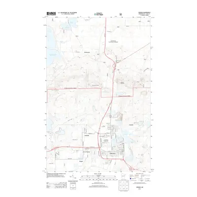
2013 Map of Virginia
USGS Topo · Published 2013About this map
The city of Virginia and its surrounding iron-range landscapes are meticulously documented in this 2013 survey. The urban core is defined by a dense grid of streets including Chestnut St W and 8th St S, situated between Silver Lake and Virginia Lake. Educational and civic infrastructure like the Mesabi Range Community and Technical College and Greenwood Cemetery are clearly visible, while the residential areas of Franklin and Parkville extend the settlement footprint.
Find a feature on this map
53 named features on this map. Tap any name to fly to it.
Don’t see what you’re looking for? This feature index may not catch every label — zoom into the map to look around manually.
Map Details
Editions of this 2013 Virginia Map
This is the sole edition of this map. No revisions or reprints were ever made.
Other maps of this area

1950 · Mc Kinley
USGS Topo · 1:24,000

1950 · Biwabik NW
USGS Topo · 1:24,000

1951 · Mc Kinley
USGS Topo · 1:24,000

1951 · Biwabik NW
USGS Topo · 1:24,000

1951 · Gilbert
USGS Topo · 1:24,000

1951 · Eveleth
USGS Topo · 1:24,000

1951 · Virginia
USGS Topo · 1:24,000

1951 · Kinney
USGS Topo · 1:24,000

1951 · Kirk
USGS Topo · 1:24,000

1951 · Britt
USGS Topo · 1:24,000
Featured Places
- Virginia, MN
- Mountain Iron, MN
- Brittmount, Mountain Iron
- Hopper, Mountain Iron
- West Virginia, Mountain Iron