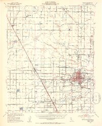
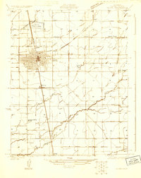
1949 Map of Visalia
USGS Topo · Published 1954About this map
Visalia serves as the hub of a complex hydraulic and transportation network in this mid-century portrait of the San Joaquin Valley. The landscape is defined by an intricate system of irrigation canals and ditches, such as the Tulare Irrigation Canal and Wutchumna Ditch, which supported the region's burgeoning agricultural industry. Transportation corridors are equally dense, with the Southern Pacific, Atchison Topeka and Santa Fe, and Visalia Electric railroads all converging near Goshen.
Find a feature on this map
92 named features on this map. Tap any name to fly to it.
Don’t see what you’re looking for? This feature index may not catch every label — zoom into the map to look around manually.
Map Details
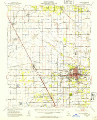
Editions of this 1949 Visalia Map
2 editions found
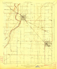
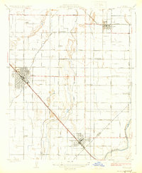
Other maps of this area

1921 · Stokes Mountain
USGS Topo · 1:24,000

1922 · Trimmer
USGS Topo · 1:96,000

1923 · Sultana
USGS Topo · 1:31,680
1924 · Reedley
USGS Topo · 1:31,680
1924 · Selma
USGS Topo · 1:31,680

1924 · Dinuba
USGS Topo · 1:125,000

1924 · Stokes Mountain
USGS Topo · 1:31,680
1925 · Tulare
USGS Topo · 1:31,680
1926 · Goshen
USGS Topo · 1:31,680
1926 · Burris Park
USGS Topo · 1:31,680