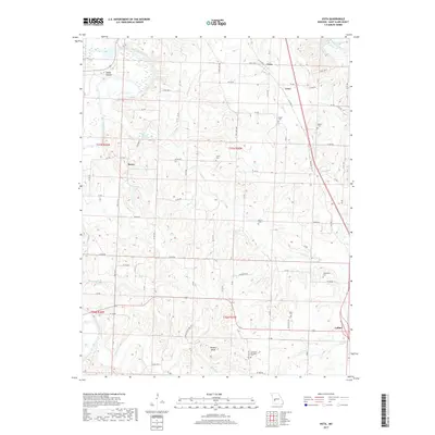
2017 Map of Vista
USGS Topo · Published 2017About this map
Sac River and its various tributaries, including Coon Cr and Brush Cr, carve a complex drainage pattern through this portion of St. Clair County. The landscape is characterized by prominent elevation features like Shryers Bluff and the low-lying Sandy Hollow to the northwest. Small settlements such as Vista, Tracy, and Raney are distributed across the township grid, while the community of Collins anchors the southeastern corner along Old Hwy 13.
Find a feature on this map
68 named features on this map. Tap any name to fly to it.
Don’t see what you’re looking for? This feature index may not catch every label — zoom into the map to look around manually.
Map Details
Editions of this 2017 Vista Map
This is the sole edition of this map. No revisions or reprints were ever made.
Other maps of this area

1886 · Stockton
USGS Topo · 1:125,000

1887 · Clinton
USGS Topo · 1:125,000

1894 · Clinton
USGS Topo · 1:125,000

1938 · Monegaw Springs
USGS Topo · 1:24,000

1938 · Roscoe
USGS Topo · 1:24,000

1938 · Vista
USGS Topo · 1:24,000

1939 · Caplinger Mills
USGS Topo · 1:24,000

1939 · Osceola
USGS Topo · 1:24,000

1939 · Arnica
USGS Topo · 1:24,000

1940 · Roscoe
USGS Topo · 1:24,000