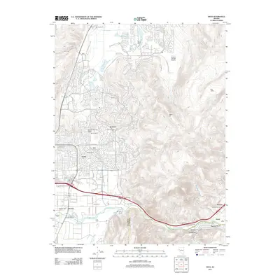
2011 Map of Vista
USGS Topo · Published 2011About this map
The Truckee River corridor east of Sparks serves as the primary artery for this portion of Washoe County, where suburban expansion meets long-standing ranching operations. The landscape is defined by the transition from the Spanish Springs Valley into the narrow defiles of Lagomarsino Canyon, following the path of the river and Interstate 80. Numerous family-named agricultural sites such as Figoni Ranch, Stevens Ranch, and the Peri Ranch sit alongside historical landmarks like the Eastman Mill and the Wedekind Post Office. The southern portion of the map highlights the institutional presence of the University of Nevada Farm, while the eastern reaches include the distinctive Mustang Ranch and the Court of Antiquity. This map captures a moment of modern residential development in the north near Spanish Springs Ranch while the southern river valley maintains its established industrial and ranching character.
Find a feature on this map
98 named features on this map. Tap any name to fly to it.
Don’t see what you’re looking for? This feature index may not catch every label — zoom into the map to look around manually.
Map Details
Editions of this 2011 Vista Map
This is the sole edition of this map. No revisions or reprints were ever made.
Other maps of this area

1891 · Carson
USGS Topo · 1:125,000

1891 · Reno
USGS Topo · 1:125,000

1893 · Carson
USGS Topo · 1:125,000

1893 · Reno
USGS Topo · 1:125,000

1950 · Virginia City
USGS Topo · 1:62,500

1950 · Mt. Rose
USGS Topo · 1:62,500

1950 · Reno
USGS Topo · 1:62,500

1951 · Reno
USGS Topo · 1:62,500

1952 · Mt. Rose
USGS Topo · 1:62,500

1952 · Virginia City
USGS Topo · 1:62,500