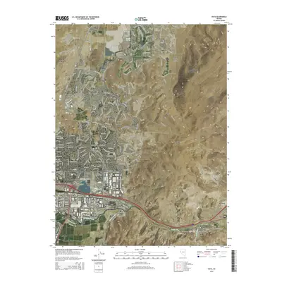
2015 Map of Vista
USGS Topo · Published 2015About this map
Truckee Meadows serves as the central focal point of this Nevada survey, where the expanding urban reaches of Reno and Sparks meet the base of the Pah Rah Range. The landscape is defined by the critical water infrastructure of the Truckee River and man-made waterways like Pioneer Ditch and Orr Ditch, which historically supported agriculture before suburban development transformed the valley. To the east, the terrain rises toward the Virginia Range, and the map documents several distinct communities along the river corridor, including Lockwood, Mustang, and Hafed. The boundary between Washoe and Storey Counties cuts through these eastern hills, marking the transition from the densely gridded streets of Sun Valley and Wedekind to the high desert canyons and the Spanish Springs Canyon.
Find a feature on this map
39 named features on this map. Tap any name to fly to it.
Don’t see what you’re looking for? This feature index may not catch every label — zoom into the map to look around manually.
Map Details
Editions of this 2015 Vista Map
This is the sole edition of this map. No revisions or reprints were ever made.
Other maps of this area

1891 · Carson
USGS Topo · 1:125,000

1891 · Reno
USGS Topo · 1:125,000

1893 · Carson
USGS Topo · 1:125,000

1893 · Reno
USGS Topo · 1:125,000

1950 · Virginia City
USGS Topo · 1:62,500

1950 · Mt. Rose
USGS Topo · 1:62,500

1950 · Reno
USGS Topo · 1:62,500

1951 · Reno
USGS Topo · 1:62,500

1952 · Mt. Rose
USGS Topo · 1:62,500

1952 · Virginia City
USGS Topo · 1:62,500