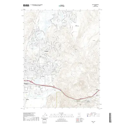
2018 Map of Vista
USGS Topo · Published 2018About this map
The Truckee River corridor serves as the primary artery for this portion of western Nevada, where the burgeoning urban footprints of Reno and Sparks meet the rising slopes of the Virginia Range. This late-decade survey details the dense residential development north of the river, contrasting with the industrial and transportation infrastructure that follows the water toward the east. The map captures the transitional landscape of Vista, where the valley narrows and the river cuts through the Pah Rah Range toward smaller settlements like Lockwood and Mustang.
Find a feature on this map
25 named features on this map. Tap any name to fly to it.
Don’t see what you’re looking for? This feature index may not catch every label — zoom into the map to look around manually.
Map Details
Editions of this 2018 Vista Map
This is the sole edition of this map. No revisions or reprints were ever made.
Other maps of this area

1891 · Carson
USGS Topo · 1:125,000

1891 · Reno
USGS Topo · 1:125,000

1893 · Carson
USGS Topo · 1:125,000

1893 · Reno
USGS Topo · 1:125,000

1950 · Virginia City
USGS Topo · 1:62,500

1950 · Mt. Rose
USGS Topo · 1:62,500

1950 · Reno
USGS Topo · 1:62,500

1951 · Reno
USGS Topo · 1:62,500

1952 · Mt. Rose
USGS Topo · 1:62,500

1952 · Virginia City
USGS Topo · 1:62,500