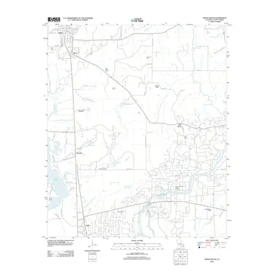
2012 Map of Vivian South
USGS Topo · Published 2012About this map
The Caddo-Pine Island Oil and Gas Field dominates the southern landscape of this Caddo Parish region, where the energy industry has long shaped the local economy and land use. Near the edge of Caddo Lake, the terrain is defined by a complex network of waterways, including the Old Channel Black Bayou, Swift Bayou Canal, and Halfway Slough. This modern survey illustrates the persistent importance of rural hubs like Vivian, Superior, and Pine Island, while documenting numerous family and community landmarks.
Find a feature on this map
74 named features on this map. Tap any name to fly to it.
Don’t see what you’re looking for? This feature index may not catch every label — zoom into the map to look around manually.
Map Details
Editions of this 2012 Vivian South Map
This is the sole edition of this map. No revisions or reprints were ever made.
Other maps of this area

1932 · Hosston NW
USGS Topo · 1:31,680

1932 · Hosston NE
USGS Topo · 1:31,680

1932 · Hosston SW
USGS Topo · 1:31,680

1932 · Hosston SE
USGS Topo · 1:31,680

1932 · Shreveport NE
USGS Topo · 1:31,680

1944 · Kildare
USGS Topo · 1:62,500

1944 · Caddo Lake
USGS Topo · 1:62,500

1946 · Caddo Lake
USGS Topo · 1:62,500

1948 · Kildare
USGS Topo · 1:62,500

1948 · Mooringsport
USGS Topo · 1:62,500