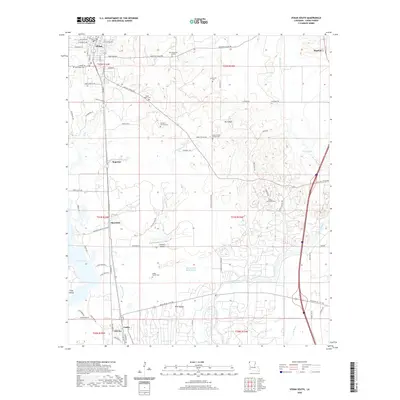
2020 Map of Vivian South
USGS Topo · Published 2020About this map
The northern edge of Caddo Lake meets a landscape defined by Bayou drainage and the historic footprints of Louisiana's early 20th-century oil industry. This survey of Caddo Parish reveals a network of smaller communities including Superior, Shoreline, and Oil City, the latter of which became famous for being the site of the world's first over-water oil well. The terrain transitions from the low-lying Halfway Slough and Old Channel Black Bayou up toward the elevation of Mt Gilead. For those researching local lineages, the map is remarkably dense with family-named landmarks and burial grounds, ranging from the Hobbs Family Cem in the south to the Hale Memorial Gardens near Vivian. This area, once dominated by logging and oil production, is shown here with its modern road networks and the continued significance of the Black Bayou waterway.
Find a feature on this map
85 named features on this map. Tap any name to fly to it.
Don’t see what you’re looking for? This feature index may not catch every label — zoom into the map to look around manually.
Map Details
Editions of this 2020 Vivian South Map
This is the sole edition of this map. No revisions or reprints were ever made.
Other maps of this area

1932 · Hosston NW
USGS Topo · 1:31,680

1932 · Hosston NE
USGS Topo · 1:31,680

1932 · Hosston SW
USGS Topo · 1:31,680

1932 · Hosston SE
USGS Topo · 1:31,680

1932 · Shreveport NE
USGS Topo · 1:31,680

1944 · Kildare
USGS Topo · 1:62,500

1944 · Caddo Lake
USGS Topo · 1:62,500

1946 · Caddo Lake
USGS Topo · 1:62,500

1948 · Kildare
USGS Topo · 1:62,500

1948 · Mooringsport
USGS Topo · 1:62,500