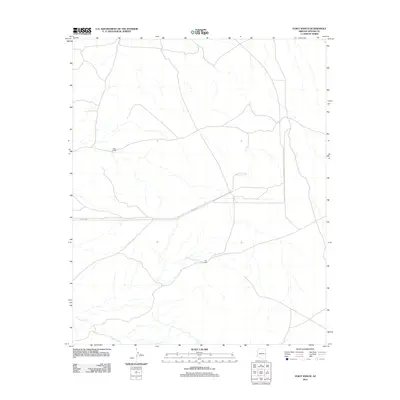
2011 Map of Voigt Ranch
USGS Topo · Published 2011About this map
Voigt Ranch and the settlement known as The Aztec anchor this rural landscape in eastern Arizona, characterized by a network of drainage systems and isolated cattle-ranching infrastructure. The southern reach of the sheet is defined by the winding course of Coyote Creek, which provides a vital water source for the arid high-desert environment. Local water access is further marked at Stamps Spring, a critical point for local land management and livestock in a region where reliable water sources are sparse. The layout of the land is structured by county-maintained routes, including Co Rd 4162 and Co Rd 4265, which connect these remote outposts. This 2011 survey illustrates the modern configuration of traditional ranching tracts and the enduring reliance on natural features like springs and creek beds to define property and utility in the Apache County backcountry.
Find a feature on this map
6 named features on this map. Tap any name to fly to it.
Don’t see what you’re looking for? This feature index may not catch every label — zoom into the map to look around manually.
Map Details
Editions of this 2011 Voigt Ranch Map
This is the sole edition of this map. No revisions or reprints were ever made.
Other maps of this area

1886 · St Johns
USGS Topo · 1:250,000

1892 · St Johns
USGS Topo · 1:250,000

1954 · Saint Johns
USGS Topo · 1:250,000

1957 · Saint Johns
USGS Topo · 1:250,000

1958 · Saint Johns
USGS Topo · 1:250,000

1962 · Saint Johns
USGS Topo · 1:250,000
1968 · Nelson Reservoir NE
USGS Topo · 1:24,000

1969 · Coyote Hills
USGS Topo · 1:24,000
1969 · Springerville
USGS Topo · 1:24,000

1971 · Mesa Parada NW
USGS Topo · 1:24,000