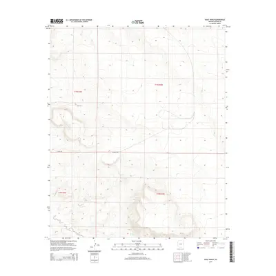
2014 Map of Voigt Ranch
USGS Topo · Published 2014About this map
Voigt Ranch sits amidst a landscape defined by the drainage of Coyote Creek and the presence of Stamps Spring in the high country of Apache County. This 2014 survey captures a sparsely settled portion of the Colorado Plateau, where the land is primarily organized by the Public Land Survey System, as evidenced by the clear township and range lines of t11n r30e and surrounding sections.
Find a feature on this map
9 named features on this map. Tap any name to fly to it.
Don’t see what you’re looking for? This feature index may not catch every label — zoom into the map to look around manually.
Map Details
Editions of this 2014 Voigt Ranch Map
This is the sole edition of this map. No revisions or reprints were ever made.
Other maps of this area

1886 · St Johns
USGS Topo · 1:250,000

1892 · St Johns
USGS Topo · 1:250,000

1954 · Saint Johns
USGS Topo · 1:250,000

1957 · Saint Johns
USGS Topo · 1:250,000

1958 · Saint Johns
USGS Topo · 1:250,000

1962 · Saint Johns
USGS Topo · 1:250,000
1968 · Nelson Reservoir NE
USGS Topo · 1:24,000

1969 · Coyote Hills
USGS Topo · 1:24,000
1969 · Springerville
USGS Topo · 1:24,000

1971 · Mesa Parada NW
USGS Topo · 1:24,000