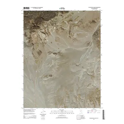
2014 Map of Volcanic Hills East
USGS Topo · Published 2014About this map
Volcanic Hills dominate the western edge of this Esmeralda County landscape, rising over a desert expanse shaped by high-altitude basins and isolated water sources. In the northern reaches, Fish Spring and Red Spring provide critical landmarks within the arid terrain, while the Columbia Valley extends toward the northeast corner. This 2014 survey documents a sparse but vital infrastructure network, centered on the North Valley Airport and two primary travel corridors. The presence of State Route 264 and Route 773 highlights the area's role as a transit link through the North Valley, connecting remote mountain ranges and wide valley floors. The map also delineates several township and range boundaries, including t1n r35e and t2n r36e, which provide an essential framework for understanding public land administration and property locations in this part of Nevada.
Find a feature on this map
14 named features on this map. Tap any name to fly to it.
Don’t see what you’re looking for? This feature index may not catch every label — zoom into the map to look around manually.
Map Details
Editions of this 2014 Volcanic Hills East Map
This is the sole edition of this map. No revisions or reprints were ever made.
Other maps of this area

1898 · Silver Peak
USGS Topo · 1:125,000

1900 · Silver Peak
USGS Topo · 1:125,000

1907 · Tonopah
USGS Topo · 1:250,000

1908 · Lida
USGS Topo · 1:250,000

1908 · Tonopah
USGS Topo · 1:250,000

1909 · Hawthorne
USGS Topo · 1:250,000

1911 · Hawthorne
USGS Topo · 1:250,000

1913 · Lida
USGS Topo · 1:250,000

1915 · Hawthorne
USGS Topo · 1:250,000

1917 · White Mountain
USGS Topo · 1:125,000