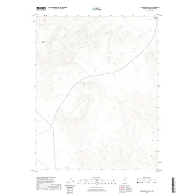
2018 Map of Volcanic Hills East
USGS Topo · Published 2018About this map
Volcanic Hills dominate the western portion of this Esmeralda County landscape, rising out of a terrain characterized by deep drainage patterns and expansive basin flats. These peaks transition into the lowlands of the Columbia Valley to the northeast, where the elevation drops toward the open desert floor. Isolated water sources like Fish Spring and Red Spring are the only named hydrological features in this arid environment, marking vital points of interest for early travelers and land managers. The built environment is sparse, centered primarily on the remote North Valley Airport near the southern boundary. This 2018 survey reveals a modern grid of township and range lines, such as t1n r35e, imposed over an ancient landscape where primitive roads like 264 and 773 provide the only significant access through the hills and across the valley floor.
Find a feature on this map
13 named features on this map. Tap any name to fly to it.
Don’t see what you’re looking for? This feature index may not catch every label — zoom into the map to look around manually.
Map Details
Editions of this 2018 Volcanic Hills East Map
This is the sole edition of this map. No revisions or reprints were ever made.
Other maps of this area

1898 · Silver Peak
USGS Topo · 1:125,000

1900 · Silver Peak
USGS Topo · 1:125,000

1907 · Tonopah
USGS Topo · 1:250,000

1908 · Lida
USGS Topo · 1:250,000

1908 · Tonopah
USGS Topo · 1:250,000

1909 · Hawthorne
USGS Topo · 1:250,000

1911 · Hawthorne
USGS Topo · 1:250,000

1913 · Lida
USGS Topo · 1:250,000

1915 · Hawthorne
USGS Topo · 1:250,000

1917 · White Mountain
USGS Topo · 1:125,000