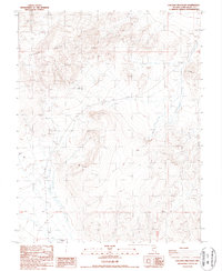
1987 Map of Volcanic Hills East
USGS Topo · Published 1987About this map
Volcanic Hills dominate this high-desert landscape in Esmeralda County, reflecting a period of mid-century mineral exploration and transit development in Nevada's Great Basin. The map details an environment defined by small-scale resource extraction, marked by numerous Prospect and Prospects sites scattered across the ridges. Evidence of human infrastructure is concentrated in the southern section, where a Landing Strip and a Gravel Pit indicate localized industrial activity. Geodetic markers like BM ll37 5108 and BM 5037 provide precise survey points across the arid terrain, while the Base Line serves as a critical boundary for land division. The presence of 4wd tracks suggests a network of primitive roads used by miners and surveyors navigating the slopes near Fish.
Find a feature on this map
13 named features on this map. Tap any name to fly to it.
Don’t see what you’re looking for? This feature index may not catch every label — zoom into the map to look around manually.
Map Details
Editions of this 1987 Volcanic Hills East Map
This is the sole edition of this map. No revisions or reprints were ever made.
Other maps of this area

1898 · Silver Peak
USGS Topo · 1:125,000

1900 · Silver Peak
USGS Topo · 1:125,000

1907 · Tonopah
USGS Topo · 1:250,000

1908 · Lida
USGS Topo · 1:250,000

1908 · Tonopah
USGS Topo · 1:250,000

1909 · Hawthorne
USGS Topo · 1:250,000

1911 · Hawthorne
USGS Topo · 1:250,000

1913 · Lida
USGS Topo · 1:250,000

1915 · Hawthorne
USGS Topo · 1:250,000

1917 · White Mountain
USGS Topo · 1:125,000