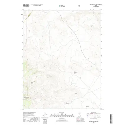
2018 Map of Volcanic Hills West
USGS Topo · Published 2018About this map
Volcanic Hills rise across this high-desert landscape in Esmeralda County, where the topography is defined by complex canyon systems and seasonal water sources. The southern portion of the quadrangle includes a section of the Inyo National Forest, marked by rugged drainages such as Trail Canyon and the broad expanse of Wildhorse Flat. Historical mining activity and remote access are evidenced by the presence of the B&B Mine Road, which snakes through the western hills near Mustang Canyon. Significant drainage networks, including Pinchot Cr and its associated Pinchot Crk Loop, illustrate the area's hydrology. Geologic and geographic landmarks like Pinyon Hill, Pinto Hill, and Sand Spring Canyon provide essential navigation points in this arid region, while Sand Spring indicates a critical, localized water source in an otherwise parched environment.
Find a feature on this map
23 named features on this map. Tap any name to fly to it.
Don’t see what you’re looking for? This feature index may not catch every label — zoom into the map to look around manually.
Map Details
Editions of this 2018 Volcanic Hills West Map
This is the sole edition of this map. No revisions or reprints were ever made.
Other maps of this area

1909 · Hawthorne
USGS Topo · 1:250,000

1911 · Hawthorne
USGS Topo · 1:250,000

1915 · Hawthorne
USGS Topo · 1:250,000

1917 · White Mountain
USGS Topo · 1:125,000

1947 · Mariposa
USGS Topo · 1:250,000

1948 · Walker Lake
USGS Topo · 1:250,000

1948 · Mariposa
USGS Topo · 1:250,000

1957 · Walker Lake
USGS Topo · 1:250,000

1957 · Mariposa
USGS Topo · 1:250,000

1962 · Walker Lake
USGS Topo · 1:250,000