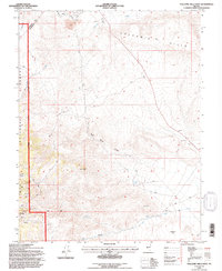
1994 Map of Volcanic Hills West
USGS Topo · Published 1997About this map
The Volcanic Hills define this high-desert landscape on the border of Mineral and Esmeralda County, where the eastern edge of the Inyo National Forest meets an active mining and ranching corridor. The map shows a region shaped by industrial extraction, featuring the F and L Mine and numerous Open Pit Mines alongside various unnamed Prospects and a Gravel Pit. The terrain is marked by significant drainages such as Sand Spring Canyon and Pinchot Creek, which navigate the space between prominent local landmarks like Pinyon Hill and Pinto Hill. A complex network of 4WD trails connects these remote sites, while an Aqueduct and the presence of Radio Towers indicate the essential infrastructure required to maintain operations in this arid environment, south of the Base Line toward Wildhorse Flat.
Find a feature on this map
23 named features on this map. Tap any name to fly to it.
Don’t see what you’re looking for? This feature index may not catch every label — zoom into the map to look around manually.
Map Details
Editions of this 1994 Volcanic Hills West Map
This is the sole edition of this map. No revisions or reprints were ever made.
Other maps of this area

1909 · Hawthorne
USGS Topo · 1:250,000

1911 · Hawthorne
USGS Topo · 1:250,000

1915 · Hawthorne
USGS Topo · 1:250,000

1917 · White Mountain
USGS Topo · 1:125,000

1947 · Mariposa
USGS Topo · 1:250,000

1948 · Walker Lake
USGS Topo · 1:250,000

1948 · Mariposa
USGS Topo · 1:250,000

1957 · Walker Lake
USGS Topo · 1:250,000

1957 · Mariposa
USGS Topo · 1:250,000

1962 · Walker Lake
USGS Topo · 1:250,000