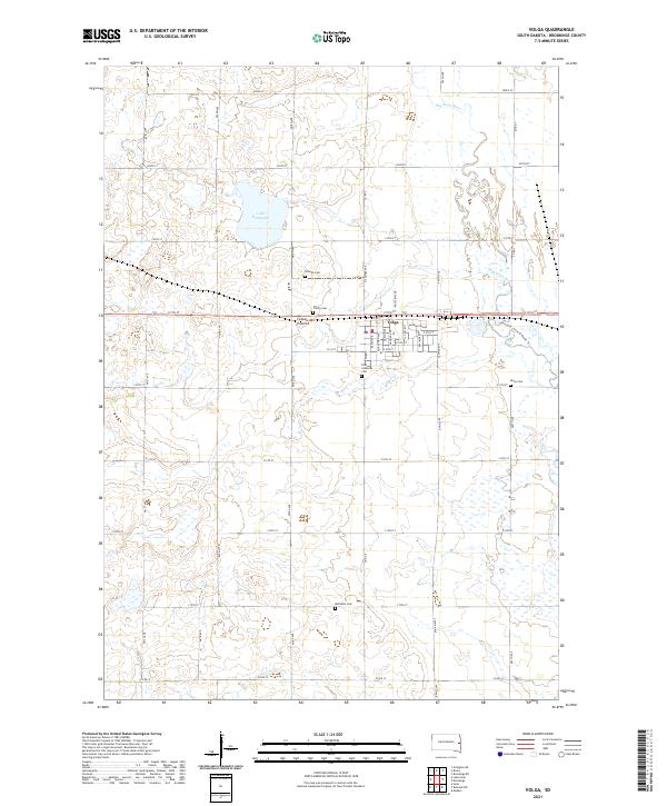
2021 Map of Volga
USGS Topo · Published 2021About this map
The city of Volga occupies a central position on this South Dakota landscape, situated upon the elevated glacial plateau of the Coteau des Prairies. This highland terrain defines the local geography, separating the basin of Lake Goldsmith to the northwest from the winding course of the Big Sioux River as it meanders along the eastern edge of the survey. The town's grid is characterized by named avenues such as Kasan Ave and Astrachan Ave, while the surrounding rural townships are dotted with several significant burial grounds including Hillside Cem, Trinity Cem, and First Lutheran Cem. Farther south, the isolated Bethania Cem and Kirby Cem provide important reference points for family historians. The presence of the Jay Heath Canoe & Kayak Trl along the river highlights the transition of the riparian corridor into a modern recreational resource.
Find a feature on this map
48 named features on this map. Tap any name to fly to it.
Don’t see what you’re looking for? This feature index may not catch every label — zoom into the map to look around manually.
Map Details
Editions of this 2021 Volga Map
This is the sole edition of this map. No revisions or reprints were ever made.
Other maps of this area

1953 · Watertown
USGS Topo · 1:250,000

1958 · Watertown
USGS Topo · 1:250,000

1964 · Brookings
USGS Topo · 1:24,000

1964 · Medary
USGS Topo · 1:24,000

1968 · Lake Sinai
USGS Topo · 1:24,000

1968 · Brookings NE
USGS Topo · 1:24,000

1968 · Bruce
USGS Topo · 1:24,000

1968 · Volga
USGS Topo · 1:24,000

1968 · Arlington NE
USGS Topo · 1:24,000

1968 · Sinai
USGS Topo · 1:24,000