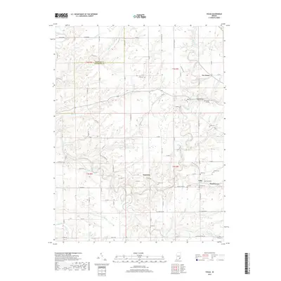
2019 Map of Volga
USGS Topo · Published 2019About this map
Lancaster and Volga anchor this portion of southern Indiana, where the rural landscape is defined by a dense network of winding waterways and family burial grounds. The territory is carved by Big Creek and the Middle Fork Creek, which dictate the placement of local roads like W Deputy Pike Rd and W Chicken Run Rd. For genealogists, the map is particularly valuable for its documentation of numerous small cemeteries, including College Hill Cem, Shiloh Cem, and Ogden Cem, which are scattered throughout the drainage basins of Hensley Creek and Graham Creek. The settlement pattern at Wakefield and Five Points reflects a long-standing agricultural tradition, with many tracts remaining accessible via traditional routes such as W 500 N and W 750 N. This 21st-century record maintains the precise locations of these landmarks as they sit across the Jennings and Jefferson county line.
Find a feature on this map
65 named features on this map. Tap any name to fly to it.
Don’t see what you’re looking for? This feature index may not catch every label — zoom into the map to look around manually.
Map Details
Editions of this 2019 Volga Map
This is the sole edition of this map. No revisions or reprints were ever made.
Other maps of this area

1939 · Madison West
USGS Topo · 1:24,000

1948 · Madison West
USGS Topo · 1:24,000

1953 · Madison West
USGS Topo · 1:24,000

1956 · Volga
USGS Topo · 1:24,000

1956 · Blocher
USGS Topo · 1:24,000

1956 · Kent
USGS Topo · 1:24,000

1956 · Deputy
USGS Topo · 1:24,000

1956 · Clifty Falls
USGS Topo · 1:24,000

1956 · Louisville
USGS Topo · 1:250,000

1959 · San Jacinto
USGS Topo · 1:24,000