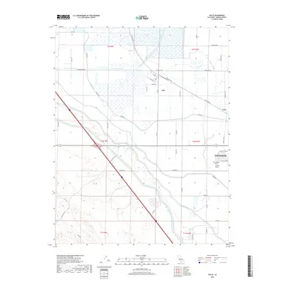
2018 Map of Volta
USGS Topo · Published 2018About this map
Volta and its surrounding agricultural lands occupy the heart of the San Joaquin Valley in this detailed survey. The landscape is defined by an intensive network of water management infrastructure, including the massive Governor Edmund G Brown California Aqueduct and the Delta-Mendota Canal, which facilitate large-scale farming across the Central Valley. These man-made waterways, alongside the Main Canal and San Luis Wasteway, dictate the development patterns of the region, where roads like Ingomar Grade and Billy Wright Rd follow the rigid grid of township lines and canal banks. Small railroad-related settlements like Trent and the outskirts of Los Banos are visible, highlighting the intersection of rail transport and irrigation that fueled the local economy. The map provides a clear view of the complex hydraulic engineering required to sustain this productive agricultural corridor.
Find a feature on this map
50 named features on this map. Tap any name to fly to it.
Don’t see what you’re looking for? This feature index may not catch every label — zoom into the map to look around manually.
Map Details
Editions of this 2018 Volta Map
This is the sole edition of this map. No revisions or reprints were ever made.
Other maps of this area

1913 · Panoche
USGS Topo · 1:125,000

1919 · San Luis Ranch
USGS Topo · 1:31,680

1919 · Ingomar
USGS Topo · 1:31,680

1920 · Pacheco Pass
USGS Topo · 1:62,500

1920 · Carrisalito Spring
USGS Topo · 1:31,680

1921 · Volta
USGS Topo · 1:31,680

1921 · Los Banos
USGS Topo · 1:31,680

1922 · Charleston School
USGS Topo · 1:31,680

1922 · Quien Sabe
USGS Topo · 1:62,500

1922 · San Luis Creek
USGS Topo · 1:31,680