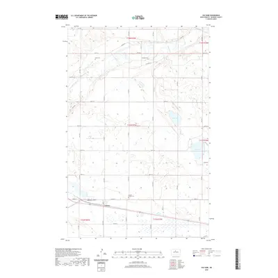
2020 Map of Voltaire
USGS Topo · Published 2020About this map
Voltaire sits near the southern edge of this McHenry County landscape, positioned where the grid of rural section roads meets the natural drainage of Blacktail Coulee. The northern reaches are defined by the meandering path of the Souris River, which carves through the prairie near River Rd N. This 2020 survey illustrates a characteristic North Dakota township pattern, where small family and community burial sites are scattered across the plains to serve isolated farmsteads. Genealogists will find several notable locations, including Hjerdahl Lutheran Cem, Westgaard Cem, and Walley Cem. The geography is further marked by local water bodies such as Stink Lake and Lake Hester, which provide essential landmarks in an otherwise highly organized agricultural landscape of section lines and range boundaries.
Find a feature on this map
34 named features on this map. Tap any name to fly to it.
Don’t see what you’re looking for? This feature index may not catch every label — zoom into the map to look around manually.
Map Details
Editions of this 2020 Voltaire Map
This is the sole edition of this map. No revisions or reprints were ever made.
Other maps of this area

1929 · Kongsberg
USGS Topo · 1:62,500

1929 · Balfour
USGS Topo · 1:62,500

1948 · Voltaire
USGS Topo · 1:24,000

1948 · Velva
USGS Topo · 1:62,500

1949 · Norwich
USGS Topo · 1:24,000

1949 · Simcoe
USGS Topo · 1:24,000

1949 · Velva
USGS Topo · 1:24,000

1949 · Voltaire
USGS Topo · 1:24,000

1949 · Karlsruhe NW
USGS Topo · 1:24,000

1951 · Velva
USGS Topo · 1:62,500