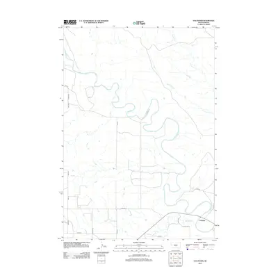
2012 Map of Volunteer
USGS Topo · Published 2012About this map
The Belle Fourche River dominates this landscape of western Meade County, carving a serpentine path through a network of tributary drainages. The small settlement of Volunteer sits in the southeastern corner of the quadrangle, serving as a focal point near the confluence of Bear Butte Cr and the main river. This region is defined by its seasonal hydrology, where numerous ephemeral watercourses like Dry Cr, Dry Fourmile Cr, and Ninemile Cr testify to the varied drainage patterns of the prairie.
Find a feature on this map
22 named features on this map. Tap any name to fly to it.
Don’t see what you’re looking for? This feature index may not catch every label — zoom into the map to look around manually.
Map Details
Editions of this 2012 Volunteer Map
This is the sole edition of this map. No revisions or reprints were ever made.
Other maps of this area

1893 · Rapid
USGS Topo · 1:125,000

1898 · Rapid
USGS Topo · 1:125,000

1903 · Rapid
USGS Topo · 1:125,000

1906 · Vale
USGS Topo · 1:62,500

1913 · Newell
USGS Topo · 1:125,000

1951 · Volunteer
USGS Topo · 1:24,000

1951 · Volunteer SE
USGS Topo · 1:24,000

1951 · Vale SE
USGS Topo · 1:24,000

1951 · Vale NE
USGS Topo · 1:24,000

1951 · Vale
USGS Topo · 1:62,500