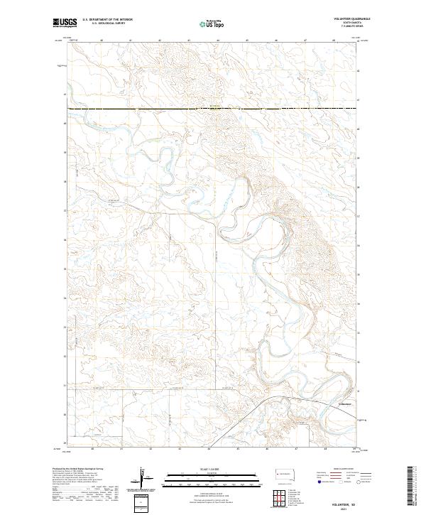
2021 Map of Volunteer
USGS Topo · Published 2021About this map
The Belle Fourche River dominates this portion of the western South Dakota prairie, carving a wide, meandering path through the landscape. Near the southeastern corner of the map, the settlement of Volunteer sits at a junction of local roads where the river meets Bear Butte Cr. This area is defined by its drainage network, with seasonal and perennial streams like Ninemile Cr and Dry Fourmile Cr feeding into the main river channel. The map illustrates a rural, agricultural infrastructure marked by a grid of county roads, including Co Hwy MC-20 and Co Hwy MC-18, which connect isolated homesteads across the townships. The boundary between Butte Co and Meade Co runs across the northern section, dividing the high plains terrain where the river valley provides a natural focal point for historical settlement and transport.
Find a feature on this map
24 named features on this map. Tap any name to fly to it.
Don’t see what you’re looking for? This feature index may not catch every label — zoom into the map to look around manually.
Map Details
Editions of this 2021 Volunteer Map
This is the sole edition of this map. No revisions or reprints were ever made.
Other maps of this area

1893 · Rapid
USGS Topo · 1:125,000

1898 · Rapid
USGS Topo · 1:125,000

1903 · Rapid
USGS Topo · 1:125,000

1906 · Vale
USGS Topo · 1:62,500

1913 · Newell
USGS Topo · 1:125,000

1951 · Volunteer
USGS Topo · 1:24,000

1951 · Volunteer SE
USGS Topo · 1:24,000

1951 · Vale SE
USGS Topo · 1:24,000

1951 · Vale NE
USGS Topo · 1:24,000

1951 · Vale
USGS Topo · 1:62,500