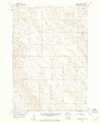
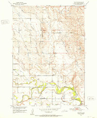
1959 Map of Volunteer NW
USGS Topo · Published 1960About this map
Eightmile Creek and Mud Creek carve through the high plains of Butte County in this late 1950s study. The landscape is defined by the open drainage basins of these prairie waterways, which were surveyed just before significant changes in regional land management. The presence of the Willow Creek Lateral in the southwest corner indicates the expansion of local irrigation efforts, providing water to a region historically dominated by ranching. Fourmile Creek meanders across the central sections, reflecting the intricate natural hydrology of the western South Dakota rangeland. This survey captures a moment of transition for the Butte County landscape, where natural water courses began to be supplemented by human-engineered water management systems to support agricultural development.
Find a feature on this map
6 named features on this map. Tap any name to fly to it.
Don’t see what you’re looking for? This feature index may not catch every label — zoom into the map to look around manually.
Map Details
Editions of this 1959 Volunteer NW Map
This is the sole edition of this map. No revisions or reprints were ever made.
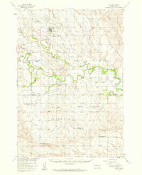
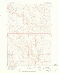
Other maps of this area

1906 · Vale
USGS Topo · 1:62,500

1913 · Newell
USGS Topo · 1:125,000
1951 · Volunteer
USGS Topo · 1:24,000
1951 · Volunteer SE
USGS Topo · 1:24,000
1951 · Vale SE
USGS Topo · 1:24,000
1951 · Vale NE
USGS Topo · 1:24,000
1951 · Vale
USGS Topo · 1:62,500

1953 · Rapid City
USGS Topo · 1:250,000

1957 · Rapid City
USGS Topo · 1:250,000
1959 · Volunteer NE
USGS Topo · 1:24,000