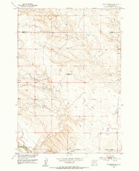
1951 Map of Volunteer SE
USGS Topo · Published 1953About this map
The Volunteer Sch and the southern reaches of the Belle Fourche river dominate this mid-century topographic record of rural South Dakota. Centered on the boundary between Butte and Meade counties, the landscape is defined by the drainage patterns of Eightmile Creek, Elm Creek, and the winding Fourmile Creek. The survey reveals a sparsely populated ranching or agricultural region where life centered around local schoolhouses and natural landmarks like Englishman Butte. A small Gravel Pit near the river suggests localized industrial activity, while the network of unimproved roads and trails illustrates the era's rural connectivity. This detailed mapping reflects the 1950s infrastructure before significant modern development, preserving the locations of remote homesteads and local waterways like Dry Fourmile Creek.
Find a feature on this map
9 named features on this map. Tap any name to fly to it.
Don’t see what you’re looking for? This feature index may not catch every label — zoom into the map to look around manually.
Map Details
Editions of this 1951 Volunteer SE Map
2 editions found
Other maps of this area

1893 · Rapid
USGS Topo · 1:125,000

1898 · Rapid
USGS Topo · 1:125,000

1903 · Rapid
USGS Topo · 1:125,000

1913 · Newell
USGS Topo · 1:125,000

1951 · Volunteer
USGS Topo · 1:24,000

1951 · Volunteer SE
USGS Topo · 1:24,000

1953 · Rapid City 1 NW
USGS Topo · 1:24,000

1953 · Hereford
USGS Topo · 1:24,000

1953 · Rapid City 1 NE
USGS Topo · 1:24,000

1953 · Rapid City
USGS Topo · 1:250,000