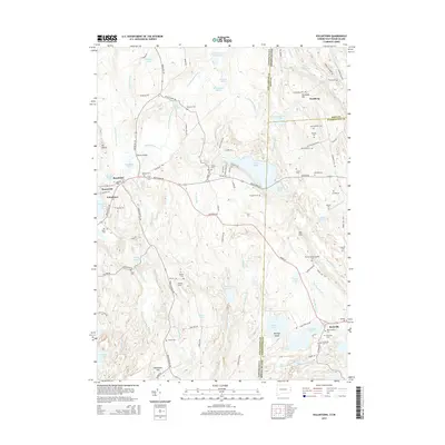
2015 Map of Voluntown
USGS Topo · Published 2015About this map
Voluntown and the surrounding borderlands of New London County, Connecticut, and Rhode Island are defined by a complex network of glacial ponds and family-named landmarks. This survey captures a landscape where agriculture and small settlements like Doaneville and Beachdale cluster near water sources such as Doaneville Pond and the Pachaug River. The area is notably dense with private family burial plots and small cemeteries, including the Old Kinne Cem, Gallup Cem, and the Nathaniel Hall Lot, providing significant detail for those tracing local lineages. The terrain transitions from the elevations of Mt Misery and Escoheag Hill down to significant wetlands like Wiccabouet Marsh. Water bodies such as the expansive Beach Pond and Yawgoog Pond straddle the state line, illustrating the shared geography of the Quinebaug and Pawcatuck river basins during this modern era.
Find a feature on this map
121 named features on this map. Tap any name to fly to it.
Don’t see what you’re looking for? This feature index may not catch every label — zoom into the map to look around manually.
Map Details
Editions of this 2015 Voluntown Map
This is the sole edition of this map. No revisions or reprints were ever made.
Other maps of this area

1889 · Stonington
USGS Topo · 1:62,500

1889 · Charlestown
USGS Topo · 1:62,500

1889 · Moosup
USGS Topo · 1:62,500

1890 · Kent
USGS Topo · 1:62,500

1893 · Moosup
USGS Topo · 1:62,500

1893 · Stonington
USGS Topo · 1:62,500

1894 · Kent
USGS Topo · 1:62,500

1919 · Charlestown
USGS Topo · 1:62,500

1920 · Moosup
USGS Topo · 1:62,500

1921 · Charlestown
USGS Topo · 1:62,500