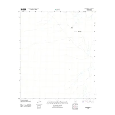
2011 Map of Vopoki Ridge
USGS Topo · Published 2011About this map
Vopoki Ridge dominates the eastern horizon of this arid landscape in Yuma County, marking a stark topographical boundary at the edge of the Davis Plain. The terrain is defined by a network of ephemeral washes and drainage patterns typical of the Sonoran Desert, where water management is highlighted by the presence of Spook Tank in the northern sector. This catchment serves the local area, likely for livestock or wildlife, as it sits near the mouth of Spook Canyon. The map reveals a largely undeveloped expanse, emphasizing the subtle geographic shifts between low-lying plains and the rising rocky outcrops of the ridge, offering a detailed view of the natural hydrology and elevation before any modern large-scale infrastructure or settlement reached this particular corner of the desert.
Find a feature on this map
4 named features on this map. Tap any name to fly to it.
Don’t see what you’re looking for? This feature index may not catch every label — zoom into the map to look around manually.
Map Details
Editions of this 2011 Vopoki Ridge Map
This is the sole edition of this map. No revisions or reprints were ever made.
Other maps of this area

1926 · Fortuna
USGS Topo · 1:62,500

1926 · Wellton
USGS Topo · 1:62,500

1929 · Fortuna
USGS Topo · 1:62,500

1929 · Wellton
USGS Topo · 1:62,500

1942 · Yuma
USGS Topo · 1:250,000

1954 · El Centro
USGS Topo · 1:250,000

1955 · El Centro
USGS Topo · 1:250,000

1958 · El Centro
USGS Topo · 1:250,000

1961 · El Centro
USGS Topo · 1:250,000

1964 · El Centro
USGS Topo · 1:250,000