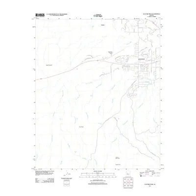
2011 Map of Vulture Peak
USGS Topo · Published 2011About this map
Wickenburg serves as the primary hub on this map, showing the town's expansion toward the Vulture Mountains to the south. The high desert landscape is defined by a dense network of drainage channels including Cemetery Wash, Yucca Flat Wash, and Hartman Wash that carve through the terrain surrounding Black Mountain. Transportation history is evident in the transition from the Old Stagecoach Rd to modern corridors and the Wickenburg Municipal Airport. Ranching and water management are represented by numerous named collection points such as Pouquette Tank, Matthie Tank, and O'Haco Tank, reflecting the necessity of water storage in this arid environment. The map also captures several local peaks including Twin Peaks and the prominent Vulture Peak, alongside the small settlement of Matthie to the north.
Find a feature on this map
38 named features on this map. Tap any name to fly to it.
Don’t see what you’re looking for? This feature index may not catch every label — zoom into the map to look around manually.
Map Details
Editions of this 2011 Vulture Peak Map
This is the sole edition of this map. No revisions or reprints were ever made.
Other maps of this area

1887 · Prescott
USGS Topo · 1:250,000

1892 · Prescott
USGS Topo · 1:250,000

1903 · Congress
USGS Topo · 1:125,000

1904 · Congress
USGS Topo · 1:125,000

1947 · Wagoner
USGS Topo · 1:62,500

1948 · Wagoner
USGS Topo · 1:63,360

1950 · Wagoner
USGS Topo · 1:62,500

1950 · Prescott
USGS Topo · 1:250,000

1954 · Prescott
USGS Topo · 1:250,000

1954 · Phoenix
USGS Topo · 1:250,000