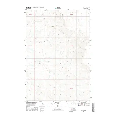
2017 Map of W L Butte
USGS Topo · Published 2017About this map
W L Butte dominates this section of Carter County, rising above a network of drainages and seasonal watercourses. The landscape is defined by its deep incisions and erosional features, including Plum Thicket Draw, W L Draw, and York Draw, which channel runoff from the high ground into various creeks. Tributaries such as Timber Cr, Keith Cr, and Middle Cr create a complex pattern of coulees and breaks across the terrain.
Find a feature on this map
18 named features on this map. Tap any name to fly to it.
Don’t see what you’re looking for? This feature index may not catch every label — zoom into the map to look around manually.
Map Details
Editions of this 2017 W L Butte Map
This is the sole edition of this map. No revisions or reprints were ever made.
Other maps of this area

1954 · Ekalaka
USGS Topo · 1:250,000

1956 · Ekalaka
USGS Topo · 1:250,000

1958 · Ekalaka
USGS Topo · 1:250,000

1965 · Ekalaka
USGS Topo · 1:250,000

1979 · W L Butte
USGS Topo · 1:24,000

1979 · Dutchman Creek
USGS Topo · 1:24,000

1979 · Chalk Buttes
USGS Topo · 1:24,000
1979 · Pocochichee Butte
USGS Topo · 1:24,000
1979 · Davis Creek West
USGS Topo · 1:24,000
1979 · Davis Creek East
USGS Topo · 1:24,000