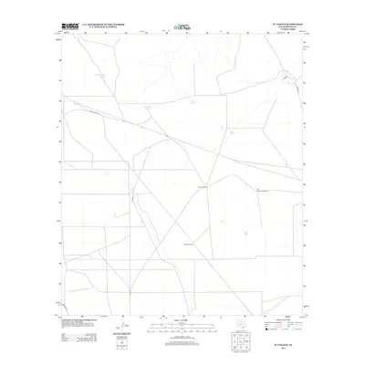
2012 Map of W T Ranch
USGS Topo · Published 2012About this map
The WT Ranch landscape in Reeves County is defined by its critical water infrastructure and remote ranching operations. In this arid corner of West Texas, the survival of livestock and the utility of the land are mapped through a network of artificial catchments and pumping stations. Distinctive labels such as Cottonwood Tank, Carruthers Tank, and High Lonesome Windmill indicate the vital points where groundwater was accessed or surface runoff captured. Transport through this territory relies on a sparse grid of local roads, including Ranch Road 2119 and several county routes like Co Rd 232, which connect the headquarters at WT Ranch to the surrounding windmills and tanks. The naming of these features, from Oscar Windmill to the Seven Up Tank, reflects the local vernacular and the practical necessity of identifying every water source across the vast grazing lands.
Find a feature on this map
17 named features on this map. Tap any name to fly to it.
Don’t see what you’re looking for? This feature index may not catch every label — zoom into the map to look around manually.
Map Details
Editions of this 2012 W T Ranch Map
This is the sole edition of this map. No revisions or reprints were ever made.
Other maps of this area

1921 · Toyah
USGS Topo · 1:125,000

1928 · Kent
USGS Topo · 1:125,000

1954 · Van Horn
USGS Topo · 1:250,000

1954 · Pecos
USGS Topo · 1:250,000

1957 · Pecos
USGS Topo · 1:250,000

1958 · Van Horn
USGS Topo · 1:250,000

1961 · Narrow Bow Draw
USGS Topo · 1:24,000

1968 · Threemile Draw
USGS Topo · 1:24,000

1968 · W T Ranch
USGS Topo · 1:24,000
1968 · Halamicek Ranch
USGS Topo · 1:24,000