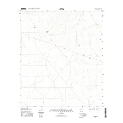
2016 Map of W T Ranch
USGS Topo · Published 2016About this map
W T Ranch stands as a focal point in this portion of Reeves County, where the landscape is defined by the vital water management systems of the Texas high desert. The map reveals a network of man-made and natural catchments essential for ranching, including Rabbit Tank, Cottonwood Tank, and Carruthers Tank. These features are strategically positioned along drainage patterns like Coalson Draw and Fourmile Draw, illustrating how water was harnessed in this arid environment. Transportation through the area is facilitated by Ranch RD 2119 and several county routes such as Co RD 232, which connect the remote ranching operations to the wider region. Topographical details such as W T Draw and Horsehead Draw further delineate the rugged terrain, providing a clear picture of the land use and hydraulic engineering necessary to sustain livestock in west Texas during the early 21st century.
Find a feature on this map
18 named features on this map. Tap any name to fly to it.
Don’t see what you’re looking for? This feature index may not catch every label — zoom into the map to look around manually.
Map Details
Editions of this 2016 W T Ranch Map
This is the sole edition of this map. No revisions or reprints were ever made.
Other maps of this area

1921 · Toyah
USGS Topo · 1:125,000

1928 · Kent
USGS Topo · 1:125,000

1954 · Van Horn
USGS Topo · 1:250,000

1954 · Pecos
USGS Topo · 1:250,000

1957 · Pecos
USGS Topo · 1:250,000

1958 · Van Horn
USGS Topo · 1:250,000

1961 · Narrow Bow Draw
USGS Topo · 1:24,000

1968 · Threemile Draw
USGS Topo · 1:24,000

1968 · W T Ranch
USGS Topo · 1:24,000
1968 · Halamicek Ranch
USGS Topo · 1:24,000