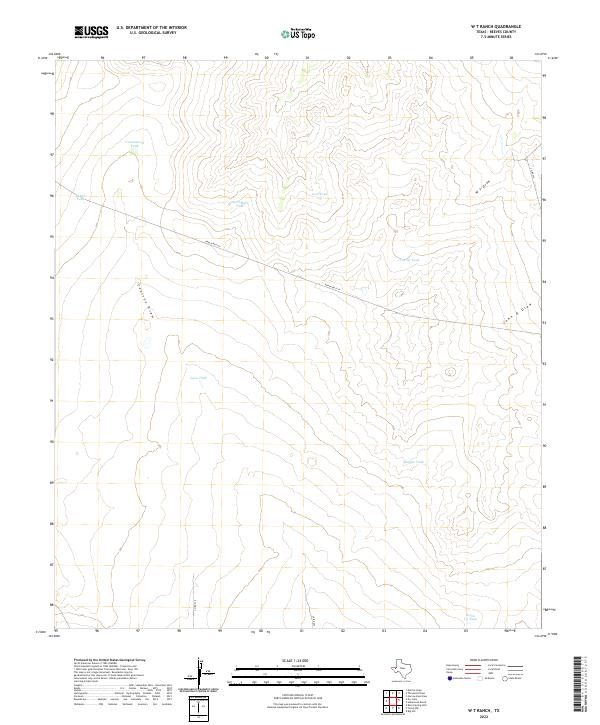
2022 Map of W T Ranch
USGS Topo · Published 2022About this map
Water management defines the arid landscape of this Reeves County rangeland, where numerous livestock tanks are the primary landmarks across the rolling terrain. Named features such as Cottonwood Tank, Carruthers Tank, and Seven Up Tank serve as vital catchments, punctuating a geography otherwise marked by dry washes and seasonal drainage systems. These ephemeral watercourses, including Coalson Draw, W T Draw, and John D Draw, illustrate the natural drainage patterns that have historically dictated movement and land use in this part of West Texas. The infrastructure is sparse, characterized by Ranch Rd 2119 and a network of county roads like Co Rd 336 and Co Rd 232, which provide access to remote ranching operations. The prevalence of these family-named and descriptive tanks, from Dagger Tank to Lynn Tank, offers a localized view of how water resources are distributed and named within the W T Ranch area.
Find a feature on this map
15 named features on this map. Tap any name to fly to it.
Don’t see what you’re looking for? This feature index may not catch every label — zoom into the map to look around manually.
Map Details
Editions of this 2022 W T Ranch Map
This is the sole edition of this map. No revisions or reprints were ever made.
Other maps of this area

1921 · Toyah
USGS Topo · 1:125,000

1928 · Kent
USGS Topo · 1:125,000

1954 · Van Horn
USGS Topo · 1:250,000

1954 · Pecos
USGS Topo · 1:250,000

1957 · Pecos
USGS Topo · 1:250,000

1958 · Van Horn
USGS Topo · 1:250,000

1961 · Narrow Bow Draw
USGS Topo · 1:24,000

1968 · Threemile Draw
USGS Topo · 1:24,000

1968 · W T Ranch
USGS Topo · 1:24,000
1968 · Halamicek Ranch
USGS Topo · 1:24,000