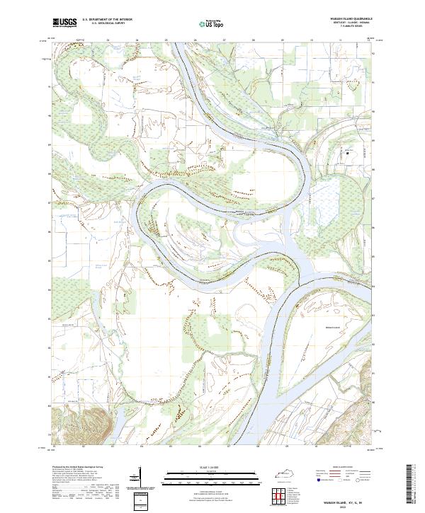
2022 Map of Wabash Island
USGS Topo · Published 2022About this map
The confluence of the Wabash River and the Ohio River creates a complex landscape of islands and backwaters where Indiana, Illinois, and Kentucky meet. The shifting river channels have left behind a dense network of secondary waterways, including the Goose Pond Scatters, Berdick Slough, and Yellowbank Slough. This fluvial environment is dominated by landmasses like Wabash Island and the uniquely named Mackeys Illinois Island Indiana, reflecting the intricate interstate boundary lines that follow old river courses.
Find a feature on this map
52 named features on this map. Tap any name to fly to it.
Don’t see what you’re looking for? This feature index may not catch every label — zoom into the map to look around manually.
Map Details
Editions of this 2022 Wabash Island Map
This is the sole edition of this map. No revisions or reprints were ever made.
Other maps of this area

1905 · New Haven
USGS Topo · 1:62,500

1906 · New Haven
USGS Topo · 1:62,500

1907 · Morganfield
USGS Topo · 1:62,500

1916 · Shawneetown
USGS Topo · 1:62,500

1917 · Uniontown
USGS Topo · 1:62,500

1949 · Paducah
USGS Topo · 1:250,000

1949 · New Haven
USGS Topo · 1:62,500

1949 · Morganfield
USGS Topo · 1:24,000

1950 · Paducah
USGS Topo · 1:250,000
1951 · Morganfield
USGS Topo · 1:24,000