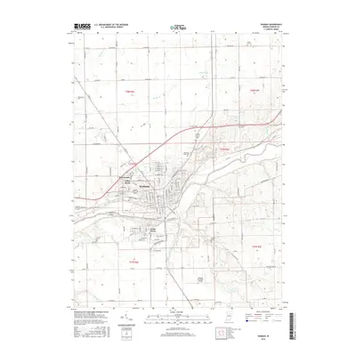
2016 Map of Wabash
USGS Topo · Published 2016About this map
The city of Wabash serves as the central hub of this 2016 survey, situated along the winding Wabash River. The urban footprint is complemented by residential neighborhoods like Sunnymede, Valley Brook, and South Haven, showing the modern expansion of the community. In the river, Potter Island sits just downstream from the city center, while Shanty Falls provides a notable landmark near the water's edge. The industrial and transportation legacy of the region is represented by the Norfolk Southern railroad line, which cuts through the city, and the Wabash Municipal Airport located to the south.
Find a feature on this map
133 named features on this map. Tap any name to fly to it.
Don’t see what you’re looking for? This feature index may not catch every label — zoom into the map to look around manually.
Map Details
Editions of this 2016 Wabash Map
This is the sole edition of this map. No revisions or reprints were ever made.
Other maps of this area

1950 · Lagro
USGS Topo · 1:24,000

1951 · Lagro
USGS Topo · 1:24,000

1951 · Richvalley
USGS Topo · 1:24,000

1952 · Wabash
USGS Topo · 1:24,000

1953 · La Fontaine
USGS Topo · 1:24,000

1953 · Somerset
USGS Topo · 1:24,000

1953 · Peoria
USGS Topo · 1:24,000

1953 · Muncie
USGS Topo · 1:250,000

1956 · Muncie
USGS Topo · 1:250,000

1961 · Roann
USGS Topo · 1:24,000