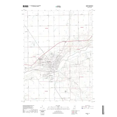
2019 Map of Wabash
USGS Topo · Published 2019About this map
The city of Wabash serves as the central hub of this Indiana landscape, situated along the north bank of the Wabash River. Residential development radiates from the core into neighborhoods like Sunnymede, Valley Brook, and South Haven, showing the modern expansion of the community. For genealogists and local historians, several burial grounds are documented, including Rode Sholem Cem, Friends Cem, and Memorial Lawns Cem. The geography is defined by the winding river and several tributaries such as Bachelor Cr, Charley Cr, and Kentner Cr. To the south, the Wabash Municipal Airport marks the transition from urban streets to broader agricultural sections, while unique features like Potter Island and Shanty Falls highlight the natural course of the waterway through Wabash County.
Find a feature on this map
93 named features on this map. Tap any name to fly to it.
Don’t see what you’re looking for? This feature index may not catch every label — zoom into the map to look around manually.
Map Details
Editions of this 2019 Wabash Map
This is the sole edition of this map. No revisions or reprints were ever made.
Other maps of this area

1950 · Lagro
USGS Topo · 1:24,000

1951 · Lagro
USGS Topo · 1:24,000

1951 · Richvalley
USGS Topo · 1:24,000

1952 · Wabash
USGS Topo · 1:24,000

1953 · La Fontaine
USGS Topo · 1:24,000

1953 · Somerset
USGS Topo · 1:24,000

1953 · Peoria
USGS Topo · 1:24,000

1953 · Muncie
USGS Topo · 1:250,000

1956 · Muncie
USGS Topo · 1:250,000

1961 · Roann
USGS Topo · 1:24,000