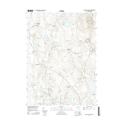
2015 Map of Wachusett Mountain
USGS Topo · Published 2015About this map
Wachusett Mountain and its smaller neighbor Little Wachusett dominate the eastern topography of this region, providing a high-elevation backdrop to the surrounding Worcester County towns. The landscape is a network of water and early transport corridors, where the E Br Ware River and S Wachusett Brook drain a terrain dotted with significant reservoirs like Mare Meadow Reservoir and Quinapoxet Reservoir. The settlement pattern reflects the area's transition from early crossroads to rail-influenced hubs, evidenced by locations such as Princeton Station, Hubbardston Station, and the village of Brooks. Genealogists will find a wealth of local history preserved in the numerous burying grounds distributed across the townships, including Tooker Cem, Rural Glen Cem, and Woodlawn Cem. From the mills near North Rutland to the secluded waters of Echo Lake, the map documents a well-established rural infrastructure of family-named hills and brooks.
Find a feature on this map
139 named features on this map. Tap any name to fly to it.
Don’t see what you’re looking for? This feature index may not catch every label — zoom into the map to look around manually.
Map Details
Editions of this 2015 Wachusett Mountain Map
This is the sole edition of this map. No revisions or reprints were ever made.
Other maps of this area

1885 · Worcester
USGS Topo · 1:62,500

1886 · Worcester
USGS Topo · 1:62,500

1887 · Winchendon
USGS Topo · 1:62,500

1887 · Barre
USGS Topo · 1:62,500

1887 · Fitchburg
USGS Topo · 1:62,500

1889 · Fitchburg
USGS Topo · 1:62,500

1889 · Barre
USGS Topo · 1:62,500

1890 · Winchendon
USGS Topo · 1:62,500

1892 · Worcester
USGS Topo · 1:62,500

1893 · Fitchburg
USGS Topo · 1:62,500