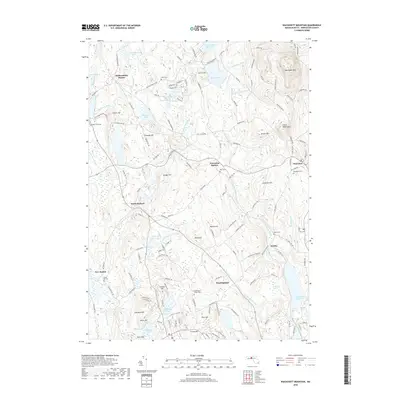
2018 Map of Wachusett Mountain
USGS Topo · Published 2018About this map
Wachusett Mtn and its neighboring peak Little Wachusett dominate the northeastern terrain of this Worcester County landscape. The area is defined by a dense network of water bodies and high points, ranging from the Mare Meadow Reservoir and Bickford Pond in the north to the Quinapoxet Reservoir at the southeastern edge. Small settlements and historical rail-linked locales like Hubbardston Station and Princeton Station are scattered across the quadrangle, connected by roads such as Old Westminster Rd and Mountain Rd.
Find a feature on this map
149 named features on this map. Tap any name to fly to it.
Don’t see what you’re looking for? This feature index may not catch every label — zoom into the map to look around manually.
Map Details
Editions of this 2018 Wachusett Mountain Map
This is the sole edition of this map. No revisions or reprints were ever made.
Other maps of this area

1885 · Worcester
USGS Topo · 1:62,500

1886 · Worcester
USGS Topo · 1:62,500

1887 · Winchendon
USGS Topo · 1:62,500

1887 · Barre
USGS Topo · 1:62,500

1887 · Fitchburg
USGS Topo · 1:62,500

1889 · Fitchburg
USGS Topo · 1:62,500

1889 · Barre
USGS Topo · 1:62,500

1890 · Winchendon
USGS Topo · 1:62,500

1892 · Worcester
USGS Topo · 1:62,500

1893 · Fitchburg
USGS Topo · 1:62,500