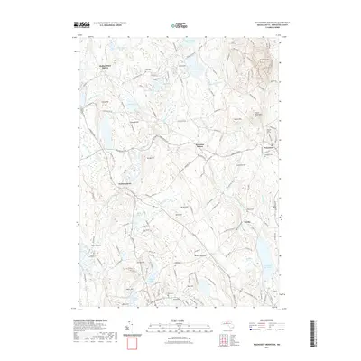
2021 Map of Wachusett Mountain
USGS Topo · Published 2021About this map
Wachusett Mtn and Little Wachusett anchor a landscape defined by significant elevation and a dense network of hiking trails such as the Semuhenna Trl and Bicentennial Trl. The area serves as a vital watershed for the region, evidenced by the large Mare Meadow Reservoir and Quinapoxet Reservoir. Local history and genealogy are preserved in numerous burial grounds, including the centrally located Meeting House Hill Cem and South Burying Ground Cem.
Find a feature on this map
164 named features on this map. Tap any name to fly to it.
Don’t see what you’re looking for? This feature index may not catch every label — zoom into the map to look around manually.
Map Details
Editions of this 2021 Wachusett Mountain Map
This is the sole edition of this map. No revisions or reprints were ever made.
Other maps of this area

1885 · Worcester
USGS Topo · 1:62,500

1886 · Worcester
USGS Topo · 1:62,500

1887 · Winchendon
USGS Topo · 1:62,500

1887 · Barre
USGS Topo · 1:62,500

1887 · Fitchburg
USGS Topo · 1:62,500

1889 · Fitchburg
USGS Topo · 1:62,500

1889 · Barre
USGS Topo · 1:62,500

1890 · Winchendon
USGS Topo · 1:62,500

1892 · Worcester
USGS Topo · 1:62,500

1893 · Fitchburg
USGS Topo · 1:62,500