Loading...
Loading map...1969 Map of Waco
USGS Topo · Published 1971About this map
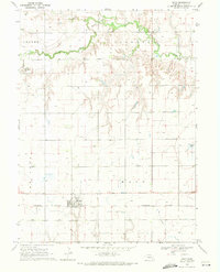
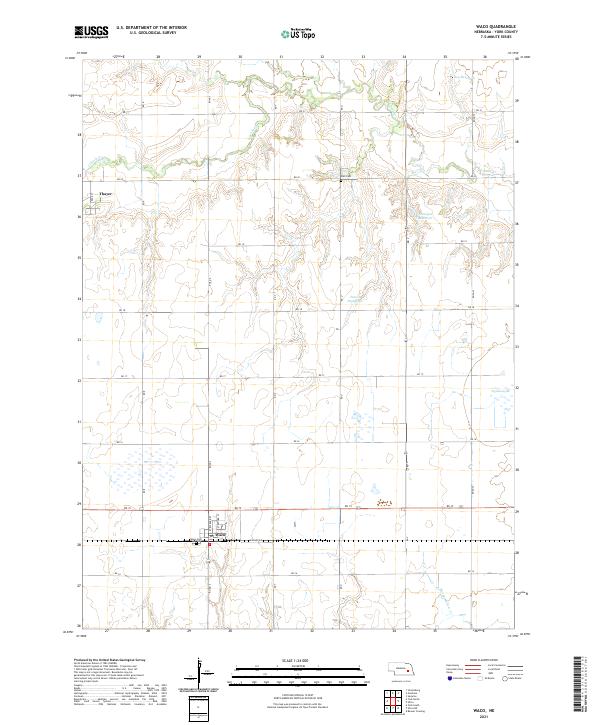
Lincoln Creek meanders through the northern plains of York County, carving a winding path through the townships of Thayer and Stewart. The landscape is defined by the rigid geometry of the section lines, punctuated by a significant Old Railroad Grade that traces the creek valley, signaling the shifting transportation priorities of the mid-20th century. Near the creek, Palo Cem sits as a quiet historical marker amidst the surrounding agricultural fields and numerous wells.
Find a feature on this map
13 named features on this map. Tap any name to fly to it.
Don’t see what you’re looking for? This feature index may not catch every label — zoom into the map to look around manually.
Map Details
Date Portrayed1969
Date Published1971
PublisherU.S. Geological Survey
Map TypeTopographic
Scale1:24,000
Physical Dimensions21.7 x 26.8 inches
Editions of this 1969 Waco Map
This is the sole edition of this map. No revisions or reprints were ever made.
Historical Maps of Waco Through Time
5 maps found
Featured Locations
Source Details
SourceU.S. Geological Survey
CopyrightPublic Domain