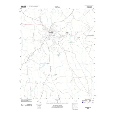
2010 Map of Wadesboro
USGS Topo · Published 2010About this map
Wadesboro serves as the central hub of this North Carolina landscape, where the intersection of several significant regional routes dictates the pattern of growth. The town's historical footprint is anchored by East View Cemetery and residential development expanding toward South Wadesboro. The surrounding countryside is defined by an intricate network of waterways, including the Goulds Fork and Brush Fork, which are interrupted by several engineered reservoirs. These water features, such as Wadesboro Municipal Lake and Lake Maree, suggest a landscape managed for local utility and recreation. Smaller industrial and rural markers like Wade Mills and family-named landmarks including Bennett Cemetery provide specific points of interest for those tracing the local genealogy of Anson County. The road network, including historical routes like Leak Ferry Rd and Stanback Ferry Rd, hints at earlier river-crossing economies that preceded modern highway development.
Find a feature on this map
69 named features on this map. Tap any name to fly to it.
Don’t see what you’re looking for? This feature index may not catch every label — zoom into the map to look around manually.
Map Details
Editions of this 2010 Wadesboro Map
This is the sole edition of this map. No revisions or reprints were ever made.
Other maps of this area

1941 · Spartanburg
USGS Topo · 1:250,000

1942 · Troy
USGS Topo · 1:125,000

1942 · Rockingham
USGS Topo · 1:125,000

1953 · Florence
USGS Topo · 1:250,000

1953 · Raleigh
USGS Topo · 1:250,000

1953 · Spartanburg
USGS Topo · 1:250,000

1953 · Charlotte
USGS Topo · 1:250,000

1954 · Charlotte
USGS Topo · 1:250,000

1954 · Florence
USGS Topo · 1:250,000

1954 · Raleigh
USGS Topo · 1:250,000