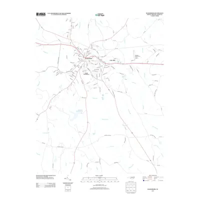
2013 Map of Wadesboro
USGS Topo · Published 2013About this map
Wadesboro serves as the central hub of this Anson County landscape, which shows a sophisticated network of residential and industrial development in the early 21st century. The map illustrates the town's expansion southward into South Wadesboro and eastward toward Wade Mills, while rural areas are defined by complex water systems like the winding Goulds Fork and Culpepper Cr. Large-scale infrastructure is prominent, including the Hightower Area Plantation Airport and several substantial water bodies such as Wadesboro Municipal Lake, Nelson Lake, and Moore Lake. The topography is marked by numerous small streams like Lampley Br and Grindstone Br that feed into the larger branches of the North Fork Jones Creek and South Fork Jones Creek, reflecting a region defined by its diverse hydrography and established transportation corridors.
Find a feature on this map
161 named features on this map. Tap any name to fly to it.
Don’t see what you’re looking for? This feature index may not catch every label — zoom into the map to look around manually.
Map Details
Editions of this 2013 Wadesboro Map
This is the sole edition of this map. No revisions or reprints were ever made.
Other maps of this area

1941 · Spartanburg
USGS Topo · 1:250,000

1942 · Troy
USGS Topo · 1:125,000

1942 · Rockingham
USGS Topo · 1:125,000

1953 · Florence
USGS Topo · 1:250,000

1953 · Raleigh
USGS Topo · 1:250,000

1953 · Spartanburg
USGS Topo · 1:250,000

1953 · Charlotte
USGS Topo · 1:250,000

1954 · Charlotte
USGS Topo · 1:250,000

1954 · Florence
USGS Topo · 1:250,000

1954 · Raleigh
USGS Topo · 1:250,000