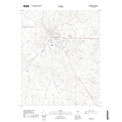
2019 Map of Wadesboro
USGS Topo · Published 2019About this map
Wadesboro serves as the central hub of this Anson County landscape, situated amidst a dense network of local creeks and family-named cemeteries. To the southeast, the town of Morven marks the lower reaches of the map, while South Wadesboro and Wade Mills represent the expanding residential and industrial footprint surrounding the county seat. The topography is defined by numerous watercourses including Culpepper Creek, Goulds Fork, and Reedy Fork, which carve through the terrain toward larger bodies like Lake Maree and Nelson Lake.
Find a feature on this map
136 named features on this map. Tap any name to fly to it.
Don’t see what you’re looking for? This feature index may not catch every label — zoom into the map to look around manually.
Map Details
Editions of this 2019 Wadesboro Map
This is the sole edition of this map. No revisions or reprints were ever made.
Other maps of this area

1941 · Spartanburg
USGS Topo · 1:250,000

1942 · Troy
USGS Topo · 1:125,000

1942 · Rockingham
USGS Topo · 1:125,000

1953 · Florence
USGS Topo · 1:250,000

1953 · Raleigh
USGS Topo · 1:250,000

1953 · Spartanburg
USGS Topo · 1:250,000

1953 · Charlotte
USGS Topo · 1:250,000

1954 · Charlotte
USGS Topo · 1:250,000

1954 · Florence
USGS Topo · 1:250,000

1954 · Raleigh
USGS Topo · 1:250,000