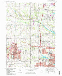
1994 Map of Wadsworth
USGS Topo · Published 1997About this map
The Connecticut Western Reserve legacy is visible across this landscape, where early agricultural lines meet the mid-century expansion of Wadsworth and Norton. Settlement patterns center on historic nodes like Sharon Center and Western Star, while the northern reaches maintain a more open character around the headwaters of Wolf Creek and Pigeon Creek. The era's infrastructure is dominated by the modern interstate system, with several interchanges including Interchange 134 near Copley carving through older farmsteads and gravel pits.
Find a feature on this map
59 named features on this map. Tap any name to fly to it.
Don’t see what you’re looking for? This feature index may not catch every label — zoom into the map to look around manually.
Map Details
Editions of this 1994 Wadsworth Map
This is the sole edition of this map. No revisions or reprints were ever made.
Other maps of this area

1901 · Massillon
USGS Topo · 1:62,500

1901 · Wooster
USGS Topo · 1:62,500

1903 · Massillon
USGS Topo · 1:62,500

1903 · Wooster
USGS Topo · 1:62,500

1903 · Akron
USGS Topo · 1:62,500

1904 · Medina
USGS Topo · 1:62,500

1905 · Akron
USGS Topo · 1:62,500

1906 · Medina
USGS Topo · 1:62,500

1950 · Cleveland
USGS Topo · 1:250,000

1951 · Canton
USGS Topo · 1:250,000