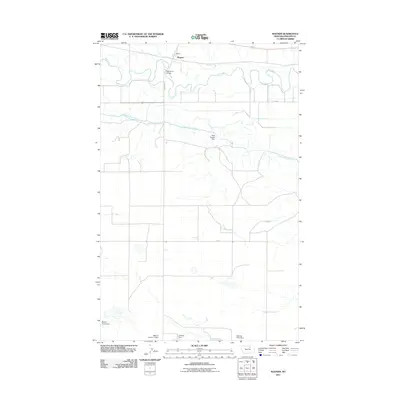
2011 Map of Wagner
USGS Topo · Published 2011About this map
Wagner serves as a central point of reference in this Phillips County landscape, situated near the meandering path of the Milk River. The area’s water management and infrastructure are central themes, evidenced by the extensive Dodson South Canal and a series of uniquely named water control structures. These include the Gilda Radner Dam, Buckin' Horse Dam, and Meeting Place Dam, reflecting a landscape heavily modified for irrigation or livestock. Transport across the river is facilitated by the Milk River Bridge, while the surrounding terrain is navigated by S Wagner RD and Rte 363. The presence of MRLCA Number 1 Dam and Halfway Dam further illustrates the significance of water collection in this part of Montana, where the interplay between natural river bends and man-made canals dictates the local geography.
Find a feature on this map
12 named features on this map. Tap any name to fly to it.
Don’t see what you’re looking for? This feature index may not catch every label — zoom into the map to look around manually.
Map Details
Editions of this 2011 Wagner Map
This is the sole edition of this map. No revisions or reprints were ever made.
Other maps of this area

1953 · Havre
USGS Topo · 1:250,000

1954 · Glasgow
USGS Topo · 1:250,000

1957 · Glasgow
USGS Topo · 1:250,000

1957 · Havre
USGS Topo · 1:250,000

1958 · Glasgow
USGS Topo · 1:250,000

1958 · Havre
USGS Topo · 1:250,000

1964 · Dodson NE
USGS Topo · 1:24,000

1964 · Dodson
USGS Topo · 1:24,000

1964 · Cow Creek
USGS Topo · 1:24,000

1965 · Wagner
USGS Topo · 1:24,000