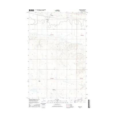
2017 Map of Wagner
USGS Topo · Published 2017About this map
Wagner serves as a central point of reference along the meandering course of the Milk River in Phillips County. This 2017 survey shows a landscape heavily influenced by regional water management, prominently featuring the Dodson South Canal and the Milk River Bridge. The terrain is marked by distinct geological depressions and drainages, most notably Davison Coulee and the North Fork Halfway Coulee to the south. Local transit and access are defined by a network of rural routes including S Wagner Loop and the evocatively named Kid Curry Rd. The map provides a detailed view of the Public Land Survey System divisions, documenting the township and range boundaries that organize this part of the Montana prairie.
Find a feature on this map
18 named features on this map. Tap any name to fly to it.
Don’t see what you’re looking for? This feature index may not catch every label — zoom into the map to look around manually.
Map Details
Editions of this 2017 Wagner Map
This is the sole edition of this map. No revisions or reprints were ever made.
Other maps of this area

1953 · Havre
USGS Topo · 1:250,000

1954 · Glasgow
USGS Topo · 1:250,000

1957 · Glasgow
USGS Topo · 1:250,000

1957 · Havre
USGS Topo · 1:250,000

1958 · Glasgow
USGS Topo · 1:250,000

1958 · Havre
USGS Topo · 1:250,000

1964 · Dodson NE
USGS Topo · 1:24,000

1964 · Dodson
USGS Topo · 1:24,000

1964 · Cow Creek
USGS Topo · 1:24,000

1965 · Wagner
USGS Topo · 1:24,000