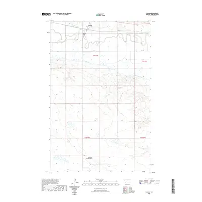
2020 Map of Wagner
USGS Topo · Published 2020About this map
Wagner serves as the focal point of this northern Montana landscape, situated along the winding course of the Milk River. This agricultural and ranching corridor is defined by its extensive water management infrastructure, most notably the Dodson N Canal, which parallels the river to support the region's productivity. The terrain transition is sharp here; the lush, low-lying river valley quickly gives way to the higher, arid plateaus of the Missouri Coteau to the south. The mapping of the Public Land Survey System (PLSS) grid highlights how human settlement and land ownership have been strictly organized around the natural flow of the river, creating a distinct visual contrast between the rhythmic meanders of the water and the rigid geometry of the surveyed sections.
Find a feature on this map
3 named features on this map. Tap any name to fly to it.
Don’t see what you’re looking for? This feature index may not catch every label — zoom into the map to look around manually.
Map Details
Editions of this 2020 Wagner Map
This is the sole edition of this map. No revisions or reprints were ever made.
Other maps of this area
1953 · Havre
USGS Topo · 1:250,000

1954 · Glasgow
USGS Topo · 1:250,000

1957 · Glasgow
USGS Topo · 1:250,000
1957 · Havre
USGS Topo · 1:250,000

1958 · Glasgow
USGS Topo · 1:250,000
1958 · Havre
USGS Topo · 1:250,000
1964 · Dodson NE
USGS Topo · 1:24,000
1964 · Dodson
USGS Topo · 1:24,000
1964 · Cow Creek
USGS Topo · 1:24,000
1965 · Wagner
USGS Topo · 1:24,000