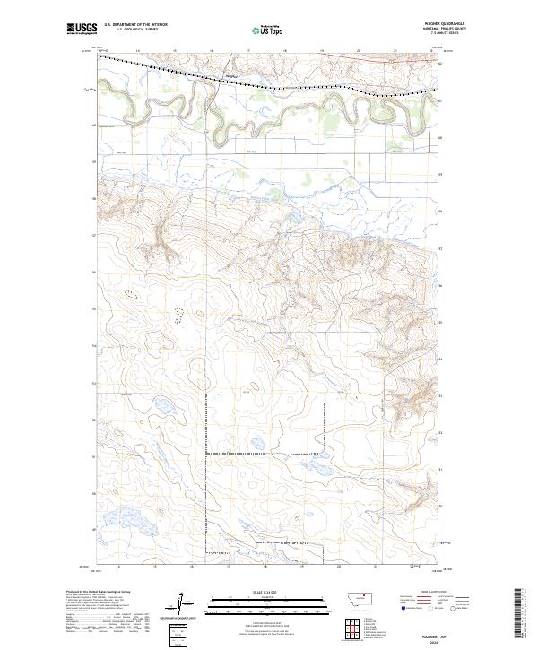
2024 Map of Wagner
USGS Topo · Published 2024About this map
The tiny settlement of Wagner sits at the northern edge of this Phillips County landscape, situated where the high plains meet the irrigation-fed valley of the Milk River. This area is defined by the complex water management systems of the Dodson North Canal and Dodson South Canal, which trace the contours of the land to support agriculture in a semi-arid region. The township boundaries of t30n r28e and t29n r28e organize a territory marked by significant elevation changes, moving from the river bottom north of Hwy 363 to the higher, coulee-cut terrain to the south. Local transit and cattle movement follow established tracks like Kid Curry Rd and Alkali Cr Rd, reflecting the ranching and irrigation history that has shaped this part of Montana for over a century.
Find a feature on this map
16 named features on this map. Tap any name to fly to it.
Don’t see what you’re looking for? This feature index may not catch every label — zoom into the map to look around manually.
Map Details
Editions of this 2024 Wagner Map
This is the sole edition of this map. No revisions or reprints were ever made.
Other maps of this area

1953 · Havre
USGS Topo · 1:250,000

1954 · Glasgow
USGS Topo · 1:250,000

1957 · Glasgow
USGS Topo · 1:250,000

1957 · Havre
USGS Topo · 1:250,000

1958 · Glasgow
USGS Topo · 1:250,000

1958 · Havre
USGS Topo · 1:250,000

1964 · Dodson NE
USGS Topo · 1:24,000

1964 · Dodson
USGS Topo · 1:24,000

1964 · Cow Creek
USGS Topo · 1:24,000

1965 · Wagner
USGS Topo · 1:24,000