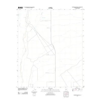
2011 Map of Wagner Wash Well
USGS Topo · Published 2011About this map
The Hassayampa River corridor and its ephemeral tributaries define the arid landscape of western Maricopa County on the outskirts of Buckeye. At this moment in the early 21st century, the map documents the expansion of the metropolitan grid into the desert, where major arterial roads like Sun Valley Pkwy and Olive Ave intersect the natural drainage of Wagner Wash. While modern thoroughfares such as W Waddell Rd and Northern Ave structure the valley's future development, the map also captures the critical water infrastructure supporting this transition, including the Wagner Wash Well and Power Line Well. These isolated water sources, along with the intermittent flows of Daggs Wash, reflect the historic reliance on groundwater in the Sonoran desert before urban sprawl fully transformed the land.
Find a feature on this map
13 named features on this map. Tap any name to fly to it.
Don’t see what you’re looking for? This feature index may not catch every label — zoom into the map to look around manually.
Map Details
Editions of this 2011 Wagner Wash Well Map
This is the sole edition of this map. No revisions or reprints were ever made.
Other maps of this area

1954 · Phoenix
USGS Topo · 1:250,000

1957 · Phoenix
USGS Topo · 1:250,000

1957 · White Tank Mts. SE
USGS Topo · 1:24,000

1957 · Valencia
USGS Topo · 1:24,000

1957 · White Tank Mts. NE
USGS Topo · 1:24,000

1957 · White Tank Mts.
USGS Topo · 1:62,500

1958 · Phoenix
USGS Topo · 1:250,000

1958 · Buckeye NW
USGS Topo · 1:24,000

1958 · Buckeye
USGS Topo · 1:62,500

1960 · Phoenix
USGS Topo · 1:250,000