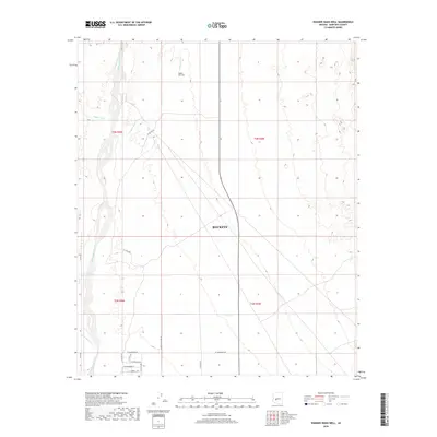
2018 Map of Wagner Wash Well
USGS Topo · Published 2018About this map
The Hassayampa River channel defines the western edge of this Maricopa County landscape, where the arid terrain of Buckeye meets a network of ephemeral desert drainages. Water resources in this environment are marked by features like the Wagner Wash Well and the braided courses of Daggs Wash and Wagner Wash. The map reflects a structured grid of western development, with survey lines and expanding infrastructure such as W Cactus Rd and W Camelback Rd pushing into the desert. This late-stage survey captures the transition of the land as arterial roads like W Bethany Home Rd and N 315th Ave create a framework for future growth across the t3n r5w and t3n r4w townships.
Find a feature on this map
21 named features on this map. Tap any name to fly to it.
Don’t see what you’re looking for? This feature index may not catch every label — zoom into the map to look around manually.
Map Details
Editions of this 2018 Wagner Wash Well Map
This is the sole edition of this map. No revisions or reprints were ever made.
Other maps of this area

1954 · Phoenix
USGS Topo · 1:250,000

1957 · Phoenix
USGS Topo · 1:250,000

1957 · White Tank Mts. SE
USGS Topo · 1:24,000

1957 · Valencia
USGS Topo · 1:24,000

1957 · White Tank Mts. NE
USGS Topo · 1:24,000

1957 · White Tank Mts.
USGS Topo · 1:62,500

1958 · Phoenix
USGS Topo · 1:250,000

1958 · Buckeye NW
USGS Topo · 1:24,000

1958 · Buckeye
USGS Topo · 1:62,500

1960 · Phoenix
USGS Topo · 1:250,000