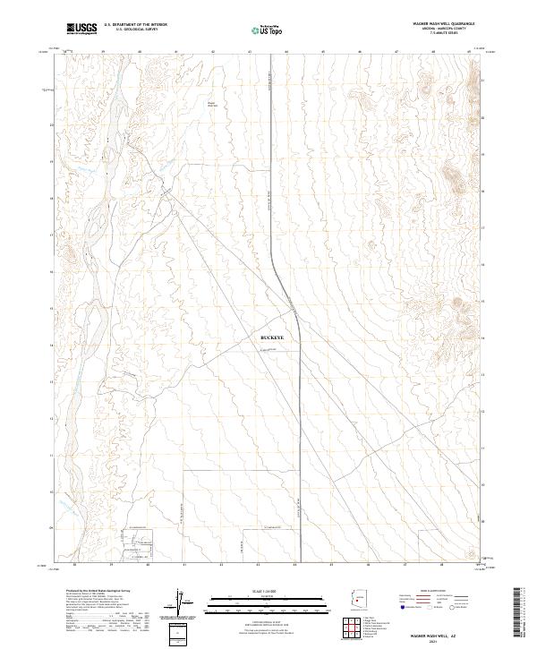
2021 Map of Wagner Wash Well
USGS Topo · Published 2021About this map
The Hassayampa River channel defines the western edge of this desert landscape in Maricopa County, where ephemeral drainage systems like Daggs Wash, Wagner Wash, and Jackrabbit Wash descend from the upland plains toward the riverbed. This arid region, centered on the Wagner Wash Well, illustrates the transition from open desert to the encroaching suburban grid of Buckeye.
Find a feature on this map
22 named features on this map. Tap any name to fly to it.
Don’t see what you’re looking for? This feature index may not catch every label — zoom into the map to look around manually.
Map Details
Editions of this 2021 Wagner Wash Well Map
This is the sole edition of this map. No revisions or reprints were ever made.
Other maps of this area

1954 · Phoenix
USGS Topo · 1:250,000

1957 · Phoenix
USGS Topo · 1:250,000

1957 · White Tank Mts. SE
USGS Topo · 1:24,000

1957 · Valencia
USGS Topo · 1:24,000

1957 · White Tank Mts. NE
USGS Topo · 1:24,000

1957 · White Tank Mts.
USGS Topo · 1:62,500

1958 · Phoenix
USGS Topo · 1:250,000

1958 · Buckeye NW
USGS Topo · 1:24,000

1958 · Buckeye
USGS Topo · 1:62,500

1960 · Phoenix
USGS Topo · 1:250,000