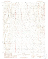
1988 Map of Wagner Wash Well
USGS Topo · Published 1988About this map
Hassayampa River flows along the western edge of this Maricopa County landscape, where the arid desert floor is carved by a network of drainage channels including Wagner Wash, Daggs Wash, and Jackrabbit Wash. This 1980s survey illustrates a landscape primarily defined by water management and resource exploration. Scattered water sources such as the Wagner Wash Well, Light Hall Well, and Power Line Well provide critical infrastructure in the dry terrain. The presence of a Mine Shaft and several prospects in the northeast quadrant indicates localized mining activity, while a network of transmission lines and a Substation reflect the expanding utility footprint during this era of Arizona's development. This topographical record is particularly useful for identifying specific well locations and mining claims that may have served local ranching or industrial interests.
Find a feature on this map
13 named features on this map. Tap any name to fly to it.
Don’t see what you’re looking for? This feature index may not catch every label — zoom into the map to look around manually.
Map Details
Editions of this 1988 Wagner Wash Well Map
This is the sole edition of this map. No revisions or reprints were ever made.
Other maps of this area

1954 · Phoenix
USGS Topo · 1:250,000

1957 · Phoenix
USGS Topo · 1:250,000

1957 · White Tank Mts. SE
USGS Topo · 1:24,000

1957 · Valencia
USGS Topo · 1:24,000

1957 · White Tank Mts. NE
USGS Topo · 1:24,000

1957 · White Tank Mts.
USGS Topo · 1:62,500

1958 · Phoenix
USGS Topo · 1:250,000

1958 · Buckeye NW
USGS Topo · 1:24,000

1958 · Buckeye
USGS Topo · 1:62,500

1960 · Phoenix
USGS Topo · 1:250,000