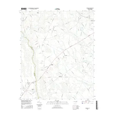
2016 Map of Wagram
USGS Topo · Published 2016About this map
Lumber River and its dense wetland tributaries shape the rural character of this landscape along the border of Hoke and Scotland counties. The area is defined by expansive swamp systems including Raft Swamp, Big Middle Swamp, and Little Raft Swamp, which historically dictated the placement of settlements and transport routes. Smaller communities like Hickory Grove, Bowmore, and Edinburgh are linked by a network of rural roads such as Turnpike Rd and Laurinburg Rd. For local historians and genealogists, the map is particularly detailed in its marking of family-named burial grounds, including Blue Cem, Purcell Cem, and McMillan Cem, offering a clear record of the area's legacy of family landholdings and small-scale hamlets like New Town and Crump Town.
Find a feature on this map
118 named features on this map. Tap any name to fly to it.
Don’t see what you’re looking for? This feature index may not catch every label — zoom into the map to look around manually.
Map Details
Editions of this 2016 Wagram Map
This is the sole edition of this map. No revisions or reprints were ever made.
Other maps of this area

1948 · Southern Pines
USGS Topo · 1:62,500

1948 · Clifdale
USGS Topo · 1:62,500

1948 · Pinebluff
USGS Topo · 1:24,000

1948 · Nicholson Creek
USGS Topo · 1:24,000

1948 · Mc Cain
USGS Topo · 1:24,000

1949 · Wagram
USGS Topo · 1:24,000

1949 · Laurinburg
USGS Topo · 1:24,000

1949 · Silver Hill
USGS Topo · 1:24,000

1949 · Wakulla
USGS Topo · 1:24,000

1949 · Laurinburg
USGS Topo · 1:62,500